 |
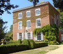
Walk 1. Two sides of Oxford Road. 1.4 miles.
See a variety of ages and types of housing including apartment
building, detached housing, terraced houses and very different
architectural styles. You may also be able to catch a glimpse of
the beautiful grade 2 listed Northcourt House |
DOWNLOAD |
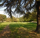 |
Walk 2. Boxhill Park and Bath
Street. 1.2 miles.
You will be surprised by the amount of green
space amongst the various houses in Abingdon. You may also like to
seek our the Norman Fitzharry's Castle Mount which, unfortunately, is
hidden by the overgrown greenery |
DOWNLOAD |
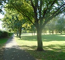 |
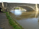
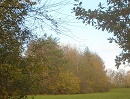
Walk 3. Ladygrove
Meadow and the River Ock. 1.6 miles.
This is a town and country walk.
Watch out for interesting wildlife on the country segment.
The walk along the Ock involves crossing four footbridges. |
DOWNLOAD |
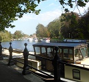 |
Walk 4. Saxton and
Caldecott
Roads. 1.8 miles.
Walk some long residential streets, see the
historic Alms Houses and enjoy lovely views of the Thames. Shows location of benches where you can take a rest. |
DOWNLOAD |
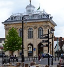 |
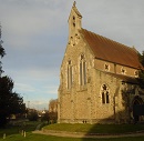
Walk 5. The sights of Abingdon.
1.5 miles
This takes you through the centre of the town
past many beautiful, historic buildings and ends with the stunning 'Ock
Valley Walk'. Shows location of benches where you can take a rest. |
DOWNLOAD |
 |
Walk 6. Longer walk
for more exercise. 3.5 miles
Long town-and-country walk of 5.6 km for
'couch to 5K' followers. You will be surprised by how much wild
countryside there is close to the town centre. |
DOWNLOAD |
 |
Walk 7. Abingdon Meadows
walk. 1.4 miles
This is a walk for the mind as much as
for exercising the body. Take you time and enjoy the
scenery. But don't attempt when the Thames is flooding.
There are many benches (not shown) on both sides of the Thames
and |
DOWNLOAD |
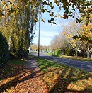 |
Walk 8. The northern edge of town.
1.4 miles
This is a gentle walk entirely on paved
paths. |
DOWNLOAD |
 |
Walk 9. Scenic North Abingdon.
1.7 miles
See some park areas in North Abingdon
along with different age housing developments. |
DOWNLOAD |
 |
Walk 10. Walk of curiosities and the
River Stert. 1.7 miles.
Starts with a lovely walk along the River
Stert and then takes you past some interesting and curious
features. Shows location of benches where you can take a rest. |
DOWNLOAD |
 |
Walk 11. Oxford Road, Radley Road and
Peachcroft. 2 or 2.4 miles.
This is a longer walk of 2.4 miles but
there is a shorter version of 2 miles if you feel less energetic. |
DOWNLOAD |
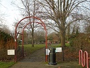 |
Walk 12. Exploring Peachcroft. 1.3
miles.
There are very many cycle and footpaths
around Peachcroft which perhaps explains why this is,
statistically, the healthiest ward in Abingdon. Shows location of benches where you can take a rest. |
DOWNLOAD |
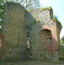 |
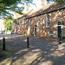
Walk 13: Daisy Bank and Barton House
ruin. 1.8 miles
Mainly an urban walk but including some
surprises like a wetland nature reserve and the ruins if Barton
Manor standing proudly in the middle of a children's play
area. I could only find two benches on this route, both by
Barton Manor. Do tell me if you know of others. |
DOWNLOAD |
 |
Walk 14: Caldecott Recreation Ground and
Southern Town Park. 2.2 miles
Enjoy the two large green spaces and the
walk along the Thames in addition to walking though different
residential areas. Includes bench locations. |
DOWNLOAD |
 |
Walk 15: Fitzharris and Shippon. 2
miles.
This is an interesting town and country
walk. Take care on the country section because the path can
be overgrown with nettles and brambles. Unfortunately, there
are no benches on this walk where you can take a rest. |
DOWNLOAD |